Posted by Founder, Bicycling Monterey
Bike advocacy, state and local: Mark Thomas, Monterey; CA SR 68; and elsewhere in California
Short link to this post: https://bit.ly/MarkThos
This post was republished October 8, 2024 to bring attention to David Schmalz’s reference to “The Mark Thomas Project” in his Oct 8 article in Monterey County Now, “The North Fremont bike path will go somewhere, eventually.” https://www.montereycountynow.com/blogs/opinion_blog/the-north-fremont-bike-path-will-go-somewhere-eventually/article_b9e81400-85d2-11ef-bd05-03d31885376f.html
David’s article notes, “Projects of any kind locally take a long time to go from the idea stage to the ribbon-cutting.” The map in his October 8, 2024 article includes streets audited by bike more than thirteen years prior. A trio of riders—Kaki Cheung (then TAMC’s bike-ped coordinator), Bicycling Monterey’s founder, and a consulting engineer for City of Monterey—biked those streets as part of bike audits done during the City’s June 28-30, 2011 transportation and parking charettes.
Portions of this post (i.e., most of its photos of Mark Thomas bike lane conditions) first published November 8, 2018, with additional info added February 27, 2019 and February 7, 2022.
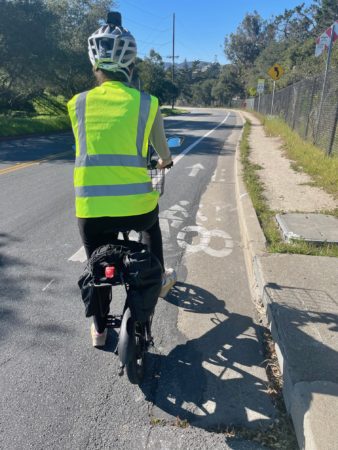
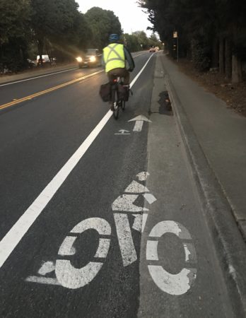
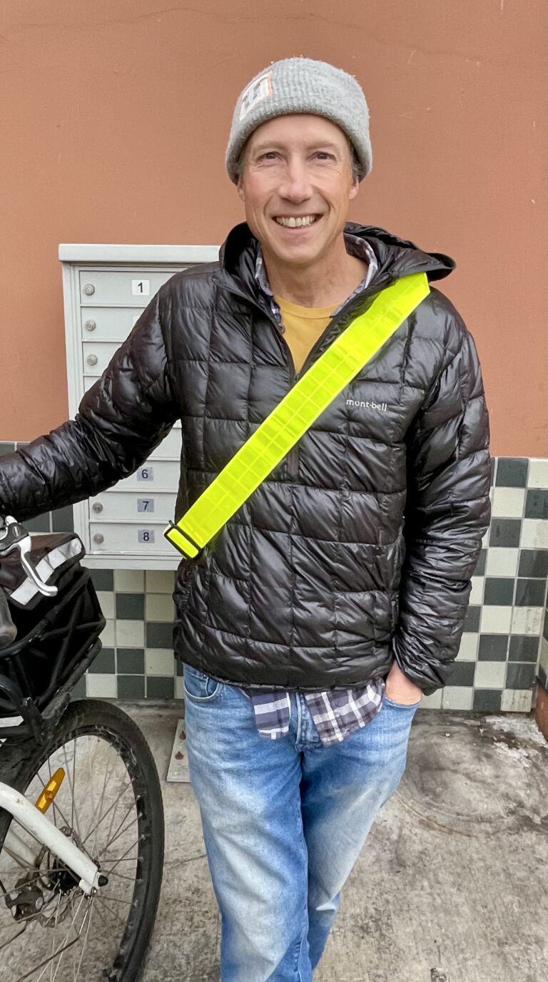
Even though biking on Mark Thomas Drive in Monterey would make their bike-to-work commute shorter, in terms of distance from their home to their workplace, the bike-to-work commuter above—pictured on a Sunday afternoon, February 6, 2022— usually avoids biking on Mark Thomas due to the uneven pavement.
On this afternoon with little traffic, it may not appear so treacherous. But Mark Thomas is often heavily used by local commuters and by tourists. In rush hour traffic, or when it’s dark, or rainy, the uneven pavement in the bike lanes on Mark Thomas is especially hazardous.
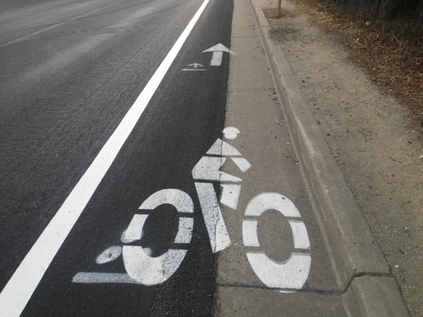
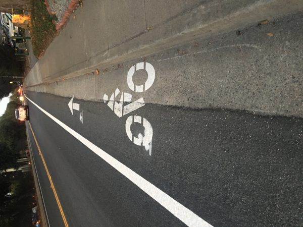
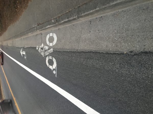
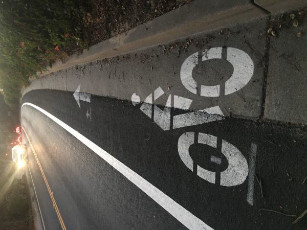
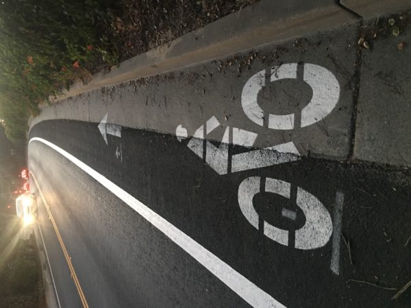
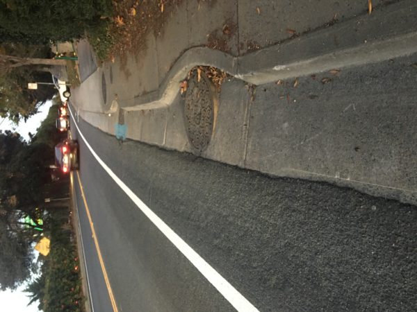
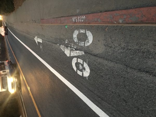
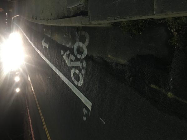
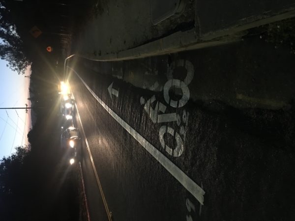
Most drivers don’t realize why people on bikes often ride as far left in the bike lane as possible—ever since California American Water did work on the road, with the resulting impact on the bike lanes as pictured in this post (more photos below).
The photos below were shot Nov 8, 2018. All show conditions on Mark Thomas Drive following work by California American Water / CalAm.
A reference to the bike lanes on Mark Thomas Drive was made in public comment #5 submitted to the Transportation Agency for Monterey County bike-ped committee for its Nov 7, 2018 meeting / http://bit.ly/BPACmtg. The photos below were first privately published (password-protected) on this site on November 8, 2018, for the convenience of City of Monterey and TAMC staff who had requested photos of conditions.
The City of Monterey responded to Bicycling Monterey’s inquiry as follows: the public works inspector investigated, and the installation was within acceptable limits for a Type 3 slurry application.
Bicycling Monterey has posted information on this site and on social media regarding Mark Thomas Drive since 2011. If you would like to discuss this or other infrastructure issues, and how to help advocate for improvements, feel free to phone Bicycling Monterey.
* * *
Info below was previously published Feb 27, 2019.
While not applicable to Mark Thomas Drive, here’s an important related topic relevant for all Californians as of February 27, 2019 [Update: #Caltrans #CompleteStreets policy Dec 2021 dot.ca.gov/news-releases/]
Complete Streets for Active Living (SB 127)
California Bicycle Coalition, of which Bicycling Monterey is a local partner, has among its current legislative priorities a Complete Streets for Active Living bill (SB 127) that would require Caltrans to implement safety improvements like protected bike lanes and sidewalks every time they repave or rebuild a state-owned road. Learn more: http://www.calbike.org/complete-streets-safety-language-e-bikes-and-scooters-top-priorities-at-bill-introduction-deadline/
For a Monterey County example of how SB 127 would benefit people who bike, refer to “A Right to the Road”: Understanding and addressing the safety of people who bike. In that post, scroll down to the 5/9/18 update about Bicycling Monterey’s request for bike boxes at some CA SR 68 intersections when Caltrans was repaving seven miles of that state-owned road.
* * *
The photos above, sans text, were first privately published (password-protected) on this site on 8 November 2018, for the convenience of City of Monterey and Transportation Agency for Monterey County staff who had requested photos of conditions. The post was first published for public viewing on February 27, 2019, with additional info added on February 7, 2022.
This post was published on 8 October 2024. One or more changes last made to this post on 9 October 2024.

